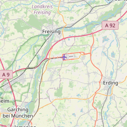
| Name | St 2580 (ref)
|
| Type | highway:primary |
| Last Updated | 2017-02-26 21:42 |
| Admin Level | 15 |
| Rank | Street / Major Landmark |
| Importance | 0.1 (estimated) |
| Coverage | Point |
| Centre Point | 48.2494612,11.8702015 |
| OSM | way 307309125 |
| Extra Tags | no (foot)
2 (lanes)
100 (maxspeed)
asphalt (surface)
|


| Local name | Type | OSM | Admin level | Distance | |
| St 2580 | highway:primary | way 307309125 | 15 | 0 | details > |
| Eder am Holz | place:isolated_dwelling | node 3039168833 | 15 | 0 | details > |
| Sollnberg | place:isolated_dwelling | node 3039272977 | 15 | 0 | details > |
| Moosinning | place:village | relation 934763 | 8 | 0 | details > |
| Hofsingelding | place:village | node 279642685 | 15 | 0 | details > |
| Riexing | place:hamlet | node 279631996 | 15 | 0 | details > |
| Lupperg | place:hamlet | node 279632037 | 15 | 0 | details > |
| St. Kolomann | place:hamlet | node 3660776638 | 15 | 0 | details > |
| Burgholz | place:hamlet | node 279647799 | 15 | 0 | details > |
| Oberneuching | place:village | node 243580234 | 15 | 0 | details > |
| Harlachen | place:hamlet | node 294205062 | 15 | 0 | details > |
| Wifling | place:village | node 279642582 | 15 | 0 | details > |
| Niederneuching | place:village | node 1700472198 | 15 | 0 | details > |
| Neuhauser | place:hamlet | node 3140548619 | 15 | 0 | details > |
| Stocker | place:hamlet | node 3140550068 | 15 | 0 | details > |
| Loher | place:hamlet | node 3140548618 | 15 | 0 | details > |
| Lausbach | place:hamlet | node 18697961 | 15 | 0 | details > |
| Itzling | place:hamlet | node 853338806 | 15 | 0 | details > |
| Lieberharting | place:hamlet | node 1388943399 | 15 | 0 | details > |
| Niederwörth | place:hamlet | node 268994469 | 15 | 0 | details > |
| Landkreis Erding | boundary:administrative | relation 62356 | 6 | 0 | details > |
| OB | boundary:administrative | relation 2145274 | 5 | 0 | details > |
| Bayern | place:state | relation 2145268 | 4 | 0 | details > |
| 85452 | place:postcode | relation 1100175 | 15 | 0 | details > |
| Deutschland | place:country | relation 51477 | 2 | ~3 m | details > |
| de | place:country_code | 0 |