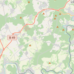
| Name | Eisenbachtal (name)
|
| Type | highway:service |
| Last Updated | 2017-02-26 22:35 |
| Admin Level | 15 |
| Rank | Minory Street / Path |
| Importance | 0.075 (estimated) |
| Coverage | Point |
| Centre Point | 50.4398375,7.905306 |
| OSM | way 245771086 |
| Extra Tags | 30 (maxspeed)
asphalt (surface)
|


| Local name | Type | OSM | Admin level | Distance | |
| Eisenbachtal | highway:service | way 245771086 | 15 | 0 | details > |
| Reckenthal | place:suburb | node 338695737 | 15 | 0 | details > |
| Wirzenborn | place:suburb | node 338695797 | 15 | 0 | details > |
| Girod | place:village | relation 453833 | 8 | 0 | details > |
| Montabaur | boundary:administrative | relation 449385 | 7 | 0 | details > |
| Westerwaldkreis | place:county | relation 62362 | 6 | 0 | details > |
| Rheinland-Pfalz | place:state | relation 62341 | 4 | 0 | details > |
| 56412 | place:postcode | relation 1153225 | 15 | 0 | details > |
| Deutschland | place:country | relation 51477 | 2 | ~3 m | details > |
| de | place:country_code | 0 | |||
Parent Of | |||||
Water_well | |||||
| Brunnenpumpe Campingplatz Eisenbachtal | man_made:water_well | node 1230375740 | 15 | ~403 m | details > |
Camp_site | |||||
| Campingplatz Eisenbachtal | tourism:camp_site | way 32853325 | 15 | ~271 m | details > |
Fire_station | |||||
| Feuerlöscher Campingplatz Eisenbachtal | amenity:fire_station | node 1230375797 | 15 | ~340 m | details > |
Restaurant | |||||
| Freimühle | amenity:restaurant | node 370071236 | 15 | ~265 m | details > |
Hotel | |||||
| Freimühle | tourism:hotel | node 370071236 | 15 | ~265 m | details > |
| Freimühle | tourism:hotel | node 414086979 | 15 | ~265 m | details > |
Bbq | |||||
| Grillplatz Campingplatz Eisenbachtal | amenity:bbq | node 1230375713 | 15 | ~404 m | details > |
Playground | |||||
| Spielplatz Campingplatz Eisenbachtal | leisure:playground | node 1230375758 | 15 | ~305 m | details > |
Hunting_stand | |||||
| No Name | amenity:hunting_stand | node 1298328993 | 15 | ~462 m | details > |
| No Name | amenity:hunting_stand | node 1298328994 | 15 | ~310 m | details > |
Picnic_site | |||||
| No Name | tourism:picnic_site | way 107014833 | 15 | ~365 m | details > |